2024 East Fall Forum and Training!!PRINT YOUR FREE PARKING PASS!! - DETAILS BELOW
Full Agenda (pdf)Agenda (online version)Register Here (closed)
Submit a presentation (deadline extended to Oct 8 due to Hurricane Helene impacts)
Submit a map (closed)
Register for training (info below)Parking Map Keynote
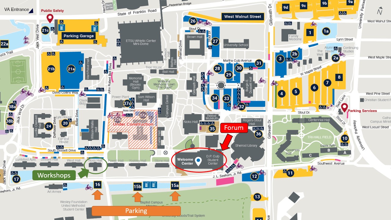
David Carney, Bristol, TN GIS Coordinator David Carney is an ETSU Geosciences graduate student alum with a diverse background working with GIS with federal entities, academia, environmental consultants, and city municipalities. David's graduate thesis used GIS to pursue his interests in paleontology with spatial data collected by museum staff over the last couple of decades at the Gray Fossil Site in Gray, TN. His thesis explored spatial trends within the dig pits at the site and led to the generation of a 3D model of one of the site's largest mastodon specimen's remains as it was deposited within the site. An ArcGIS Storymap detailing his thesis was awarded the "viewer's choice award" at the 2021 annual TNGIC conference. David is currently teaching a few geosciences classes at ETSU and working as the GIS coordinator for the City of Bristol, providing GIS data/maps/products to all city departments, city of Bristol citizens, and consultants alike. Training InformationNo cost! Where - ETSU Geosciences Department (Ross Panhellenic Hall, 247 S Dossett Dr) – In room 323 (GIS Lab) Introduction to Ground Penetrating Radar 9:00 AM – 12:00 PM – Dr. Eileen G. Ernenwein In this 3-hour workshop, participants will gain hands-on experience with ground penetrating radar subsurface imaging technology. The workshop covers the fundamentals of GPR, including data collection strategies, instruments and configurations, data processing, and interpretation of results. Through practical exercises and real-world case studies, you'll learn how to identify and analyze underground features such as pipes, archeological features, and graves. Computers are provided in our GIS lab, but you are also free to bring your own and can install a demo version of the GPR software. Exploring Uncrewed Aerial Systems 1:00 PM – 3:30 PM – Dr. Matthew Beer & Mr. Steven Jones Check out live demos of multiple UASs, including the Matrice 300RTK+Zenmuse L1 LiDAR system, the Mavic 3T Thermal system, and the Phantom 4+Multi-Spec system. Learn how these systems work and the data that can be collected from them. A short lab session will also provide you with basic imagery processing steps using Metashape and other software. Register for training (Monday Oct. 14th, 2024)
|